Umfassende und fundierte Daten zum weltweiten Windenergiemarkt aus einer Hand.
-
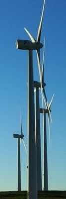
The Wind Power ist eine einzigartige, professionelle Datenbank für die weltweiten Akteure des Windenergiesektors.
Richtungsweisende Entscheidungen erfordern zuverlässige und aktuellste Daten. Beides bietet The Wind Power einem hochqualifizierten und internationalen Fachpublikum.
Sie sind Windkraftanlagenhersteller, Windparkentwickler, Betreiber, Dienstleister im Bereich Logistik, Transport oder Wartung, ein Consulting-Unternehmen, Wissenschaftler oder im Medienbereich tätig?
Bei The Wind Power finden Sie umfangreiche quantitative und qualitative Informationen als Grundlage für die Entwicklung Ihrer Projekte oder Ihrer Verkaufsstrategie, für die Forschung sowie statistische Auswertungen und Veröffentlichungen. -

Wir wünschen uns zufriedene Kunden, Nutzer und Datenlieferanten, deshalb spielen Transparenz, Qualität und Reaktivität für uns eine besonders wichtige Rolle.
Zu jeder Datei und jeder gesuchten Information geben wir die Anzahl der Einträge bzw. den Füllgrad exakt an und bieten Ihnen eine kostenlose Vorschau auf die enthaltenen Daten.
Die gesamten Daten werden systematisch und in regelmäßigen Abständen - maximal alle 6 Monate - überprüft und ergänzt. Wir informieren Sie über das exakte Datum der letzten Aktualisierung.
Bei Fragen zum Inhalt der Dateien, bei besonderen Wünschen oder wenn Sie Hilfe bei der Auswertung benötigen, wenden Sie sich bitte direkt an Herrn Michael Pierrot. -

Datenbank und Berichte